
Telemark Adventure Run Kelowna
October 23rd 2022 9:00am - 1:00pm
Organizers: Kevin Matrosovs (Event Director), Kevin Matrosovs (Course Planner), Tammy Howe (Organizer), Patricia Artuso Patton (Assistant), Chris Ford (Assistant), Joanne Woods (Assistant), Adam Woods (Assistant), Kevin Matrosovs (Permit), David Bakker (Assistant)
Post-Event
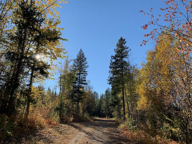
Many thanks to Telemark Nordic Club for supporting this event and providing such a great location for some spectacular autumn orienteering! It was great to see so many juniors, newcomers and experienced orienteers out enjoying the challenge, the terrain, and the views.
GPS Track Upload
- Upload your GPS track from the run, and we will overlay them on the event map and animate it.
Preliminary Results
- A few parents on teams did not use SI sticks to collect points and are not listed here, but their teammates are. The lists of collected controls will hopefully be posted in the near future.
- See uploaded GPS tracks plotted on the course map. Only 3 Hour tracks uploaded so far.
Updates
Registration is now officially closed. If you didn't get a chance to register but would still like to participate, we will have just a few extra maps. Please contact Kevin, the event director, at xnavor AT gmail DOT com, or, if you are a Telemark junior training member, please contact your coach.
Overview
We are excited to be able to present an orienteering / adventure running event on a brand new map covering most of the ski and snowshoe trail network and forest of the Telemark Nordic Club!
This is a Score-O style adventure run on a new computer-generated map. 1.5 and 3 hour categories are on offer. You choose how far and how long -- within the time limit -- you want to go. Come out and experience the Telemark trails and forest before ski season!
Location, Parking, and Map
This event will take place on a brand new map covering the area of the Telemark Nordic Club trail network and some additional nearby forest. Parking is at the Telemark parking lot and the start/finish is in the arena in front of the main Telemark lodge.
The map is all you need to choose your own adventure. It will have all the checkpoints clearly marked on it, and will clearly show which areas are out of bounds. A compass may be beneficial on the longer course, but is not needed (the map is oriented to magnetic north, so no declination is required).
The map is not quite a standard orienteering map. It does, however, have vehicle tracks, trails, water features (creeks, ponds, and marshes, which are likely fairly dry now), 5-metre contours, some boulders and cliffs, and computer generated vegetation density. While all of the trails have been verified, most of the off-trail terrain between trails has not been field-checked.
Courses
Everyone gets exactly the same map, it has a mix of different checkpoint difficulties and distances from the start/finish. This event will skew towards easier and more on trail navigation than our typical events.
Different checkpoints will be worth different points depending on
how far away they are or how difficult they are to find. The goal is to
collect as many points as you can within the time limit.
Course Options:
You get a choice of how long you
want to be out there, and we will compare results and routes within two
different time limits:
- 1.5 Hour Adventure Run
- 3 Hour Adventure Run
Mandatory and Recommended Equipment
Mandatory Equipment:
- Map -- we will provide this
- Whistle -- for emergencies
- Watch and/or mobile phone -- so that you can return to the finish on time!
Recommended and Optional Equipment:
- Water -- especially on the 3 Hour course
- Energy food / snacks -- especially on the 3 Hour course
- Appropriate clothing for the weather
- Long pants / leg covering to protect your legs if you plan to run fast off trail through the forest
- Compass is optional
New Orienteers
We are making this event friendly to new orienteers. We are offering very beginner friendly courses and will ensure we have someone available at check-in to help you with getting started in the sport. We look forward to meeting you!
We encourage those new to orienteering and forest navigation to team up and participate as a group of 2-3.
Juniors age 15 and under MUST participate in groups of 2-3.
Schedule
This is a one day, in person, event on Sunday October 23.
- 09:00 - Check-in Opens
- 09:15 - Orientation and Introduction to Orienteering
- 09:45 - Maps Handed Out - Plan Your Route Now!
- 10:00 - Start
- 11:30 - 1.5 Hour Finish
- 13:00 - 3 Hour Finish
Registration
To register for the event, follow the appropriate directions below for Sage members, Telemark camp participants, or non-members (neither).
Fee Payment: Payment of the fees will be in cash on-site at check-in.
Registration Deadline: Thursday, October 20 at 23:59 (11:59pm).
Sage Orienteering Club Members:
- Adult (age 21 and older): $15
- Junior (age 20 and under): $10
- Family Maximum: $30
- Sign-up for the 1.5 Hour or 3 Hour category using the appropriate green button on this page.
Telemark Nordic Camp Participants:
- Everyone: $5
- All Telemark participants will be in the 1.5 hour category.
- Check with and organize payment through your Telemark coach.
- Complete the appropriate on-line form, links provided by your Telemark coach and reproduced here as well:
- Adults (age 19 and older) complete the Waiver.
- Minors (age 18 and under) and their parent or guardian complete the Consent and Assumption of Risk.
Non-Members:
To register, you can first become a Sage Orienteering Club member (membership expires at the end of this year) and then register as described above for Sage members. Or, you can do the following:
- Adult (age 21 and older): $20
- Junior (age 20 and under): $15
- Family Maximum: $40
- Sign-up for the 1.5 Hour or 3 Hour category using the appropriate green button on this page.
- Complete the appropriate on-line form as follows:
- Adults (age 19 and older) complete the Waiver.
- Minors (age 18 and under) and their parent or guardian complete the Consent and Assumption of Risk.
Safety
Prepare to be self-sufficient for the duration of your run!
- All participants must report to the finish, so we know you're safe.
- All participants must carry a whistle for use in emergencies.
- Juniors age 15 and under MUST participate in groups of 2-3.
- BE BEAR AWARE. Consider carrying bear spray if you're on a longer course and are nervous about bear encounters.
- There may also be moose in some areas of the forest. If you hear or see one, give it a wide berth.
- There are no water stations on the course. Take some with you, especially on the 3 hour course.
- Consider taking some food if you're on the 3 hour course.
Results
SI Air timing will be used for this event. Timing chips for borrowing are including in your registration price. We also encourage you to track your run/walk with a GPS, so we can put together an animation of where everyone went. We will be manually calculating your points, and will publish results and routes once the event is over.
Scoring
Depending on how far the checkpoint is from the start/finish and how difficult it is to find it is worth a different amount of points. The most challenging checkpoints are worth 120 points, intermediate difficulty checkpoints are 80 points, and the closest and easiest are worth 40.
For each minute that you or your team is back late past your time limit, a penalty of 20 points is deducted from your score. Don't be late!
