
Lower Postill Spring Opener Kelowna
April 16th 2023 10:00am
Organizers: Tammy Howe (Event Director), Kevin Matrosovs (Controller), Tammy Howe (Course Planner), Kevin Matrosovs (Course Planner), David Bakker (Assistant)
Map: Lower Postill
Updates
April 14: Registration deadline extended to 12:00 noon on April 15.
Overview
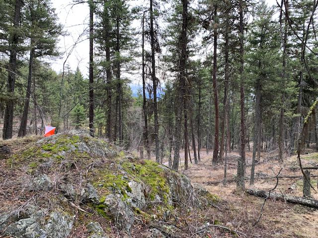
This first event of the 2023 Kelowna orienteering calendar takes place in the fantastic detailed terrain on the Lower Postill map behind the Kelowna airport.
The Lower Postill terrain is a beautiful open forest with numerous rock and contour features and a significant trail network.
This activity will be on the same newly expanded map as last year's event here. For those who've done previous events here, the former sprint standard map has been redrafted to a forest standard and expanded to include new terrain. If you missed running on this fantastic new map last year, come check it out!
This in-person event will have full orienteering controls with SI timing.
Schedule
April 16: In-person activity with on-site help and socializing.
- 09:30 -- Check-in opens with help and coaching available.
- 10:00-13:00 -- Do the Novice, Intermediate or Advanced course on your own while the event staff are on-site.
Registration
Registration Deadline: April 15 at 12:00 noon.
For 2023, we are using a new registration system: 2M Events. Sage club membership and event registration will be done using this system.
- To register for the event, you must be a 2023 Sage Orienteering Club member or register as a visiting member of another orienteering club. If you have not yet done this, sign up (includes a waiver) here. Or, you can sign up directly for the event using the following link and the system will direct you to also register for your Sage club or visitor membership at the same time.
- Register for the Lower Postill event here or using the big green Register button on this page.
Cost
The entry fee for this event is $10 for adults and $2.50 for juniors.
Location, Parking, and Map
The start/finish location is on Postill Lake Rd a short distance past the intersection with Farmers Dr. See the pin on the map below.
This area is popular with off-road vehicle users and there is a significant trail network. Keep your ears open for ATVs and dirt bikes.
Courses
Controls will be marked in the terrain using standard orienteering control flags with SI timing units on them. The courses are roughly as follows:
Novice: 2.1 km -- On-trail loop with easy navigation and all controls on or near trails.
Intermediate: 2.7 km -- Longer loop with off-trail travel, controls and navigation; and significant climbing and descending.
Advanced: 4.5 km -- Longest loop with significant off-trail travel and controls and the most challenging navigation.
COVID Safety
Please stay home if you have any symptoms of COVID-19 or illness.