
Kelowna Nordic Kelowna
July 18th 2020 7:00am - August 9th 2020 5:00pm
Organizers: Kevin Matrosovs (Event Director), Kevin Matrosovs (Course Planner), David Bakker (Assistant)
Map: Kelowna Nordic
Quick Links
Registration is now closed.
Location and Map
This event is in a new location at the Kelowna Nordic Ski and Snowshoe Club main lodge. It is a roughly 35 minute drive from the intersection of Highways 33 and 97 in Kelowna.
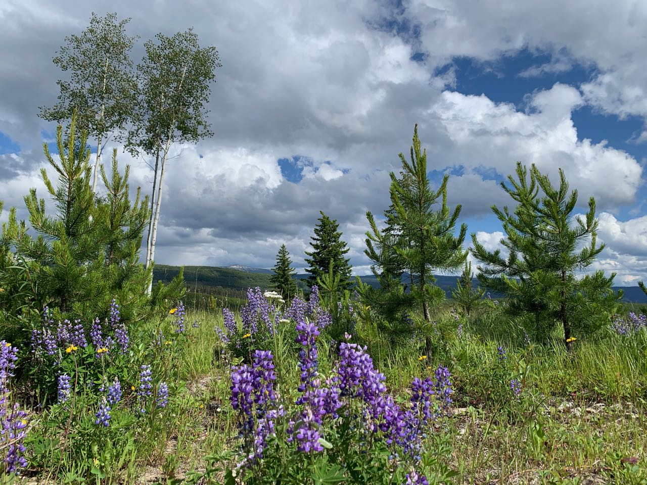
The wildflowers are spectacular right now!!
The map is brand new this spring. We have not had time to finish it to full orienteering standard. In particular, the vegetation is 100% computer generated and some details such as some boulders may be missing from the map. The major trails of the Kelowna Nordic ski network provide solid catching features. This map has not been fully field checked, so please keep in mind that there may be some details that are not reflected on the map.
Having said the above, the map should be good enough to enjoy some fun orienteering!
Courses
The start/finish location is at the Kelowna Nordic Ski and Snowshoe Club main lodge.
If your printed map is black and white, you can carry a cell phone with the pdf on it to check the map in colour if you need it, which can be helpful to identify features such as vegetation density, open land and marshes. The Staples self-service print shop is now open and has colour laser printers that cost $0.46 per copy.
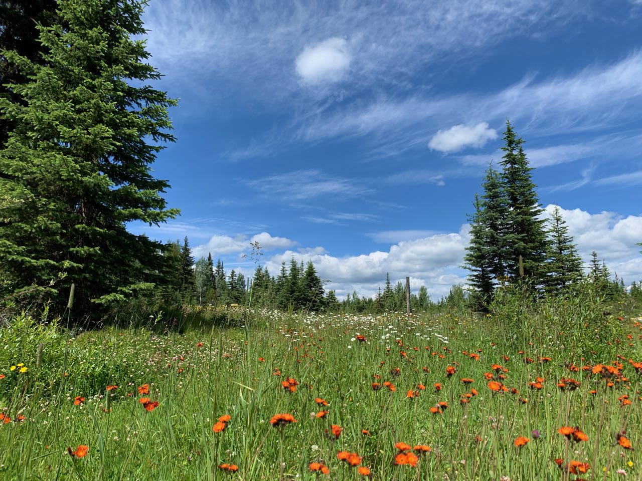
There is a lot of open terrain. If it is hot and sunny, make sure to bring sunscreen and sufficient water, especially on the advanced course.
The mosquitoes are quite numerous and hungry pretty much everywhere this year. Unless you're running, and maybe even then, bring bug spray. Enjoy!
Beginner: 2.2 km straight line distance generally following major trails or forest rides that stay fairly close to the main lodge. Most controls are on or near trails or rides with options for some short, fun off-trail sections.
Advanced: 5.8 km straight line distance with a lot of variety ranging from beautiful detailed forest to marshes to open cut blocks. Most controls are off-trail and there are route choice options including using the trails and rides vs more direct off-trail travel.
Overview
Due to the exceptional global circumstances at the moment, we will not be having our usual events. Instead, we are setting up trainings that can be completed in your own time, any time, over the coming weeks. For all the trainings we will be hanging some flags in the woods for a few weeks, and individually emailing out maps. You print out the pdf to get your own map (or if you are very careful, keep it on your cellphone) to use.
We are choosing training location very carefully to be locations
that tend to have low public use to maximize social distancing, but are
relatively close to the city to minimize travel. We will be on
forested maps exclusively, and not using any of the park maps in the
city that are already over-crowded. We have some new maps in the works,
but will also be returning to some previously used ones.
Precautions
- Read through the Orienteering Canada Self-Guided Orienteering Guidelines.
- Please stay home if you have any symptoms of COVID-19 or illness.
- Please stay home if you have been in close contact with a confirmed or probable case of COVID-19 in the last 14 days.
- Only participate in orienteering activities with individuals from your COVID-19 bubble.
- Stay at least 2 metres away from all other park/wilderness users and do not congregate at the trailheads or control sites.
- Do not touch the control (checkpoint) flags – just get within 5 metres or so.
- Walk/run with extreme caution to avoid any injuries.
- This is moose and bear habitat. Carrying bear spray is according to your comfort level but is a good idea.
- It can be hot in July. Wear sunscreen and carry sufficient water and electrolytes.
- Mosquitoes!!
Cost
These trainings are being offered as a free mental health service to all Sage Orienteering Club members. Now is a great time to go for a run by yourself or in a very small group in the beautiful Okanagan nature.
How it Works
- Register your Sage Orienteering Club membership online. Membership Registration (including payment) and waiver (youth waiver, adult waiver) both need to be filled in online this year.
- Send an email to xnavor@gmail.com to register for the course of your choice and let us know how many of you are going. We will email you a map individually - so make sure your email address with your WhyJustRun account is accurate.
- Run the course whenever you want during the times when the event is open. If you are interested in comparing results & routes with others, record a GPS track on your smartwatch or phone.
- (Optional) Upload a .gpx file (you can export this from Strava, Garmin Connect, Attackpoint, and many others) to our website (link will be posted once registration is open) which will calculate your split times. We will also then overlay all the GPS tracks onto the map together so you can compare route choices with others. We might not be able to gather socially, but we can still talk about or route choices digitally.
How You Can Help
These events are running entirely on volunteer manpower. We would love some help if you would be willing to pick up controls at a specified times at the end of each event, and handing them on to the next volunteer who will put them out.