
Spion Kop West Kelowna
May 17th 2020 8:00am - May 31st 2020 5:00pm
Organizers: Kevin Matrosovs (Event Director), Kevin Matrosovs (Course Planner), David Bakker (Assistant)
Map: Spion Kop
Post-Event
We are taking a few weeks off organizing events to give our volunteers a bit of a break, and to make some new maps so we don't have to start re-using areas just yet. We are planning on having more orienteering set up around the Kelowna area in a few weeks.
- Beginner
- Intermediate
- Results
- 3DRe-Run - There was only one GPS track upload so it will be sent out personally in a non-animated fashion.
- Advanced
Location and Map
This event is on a different part of the Spion Kop trail network and map than the previous event. The start/finish location is described below under Courses.
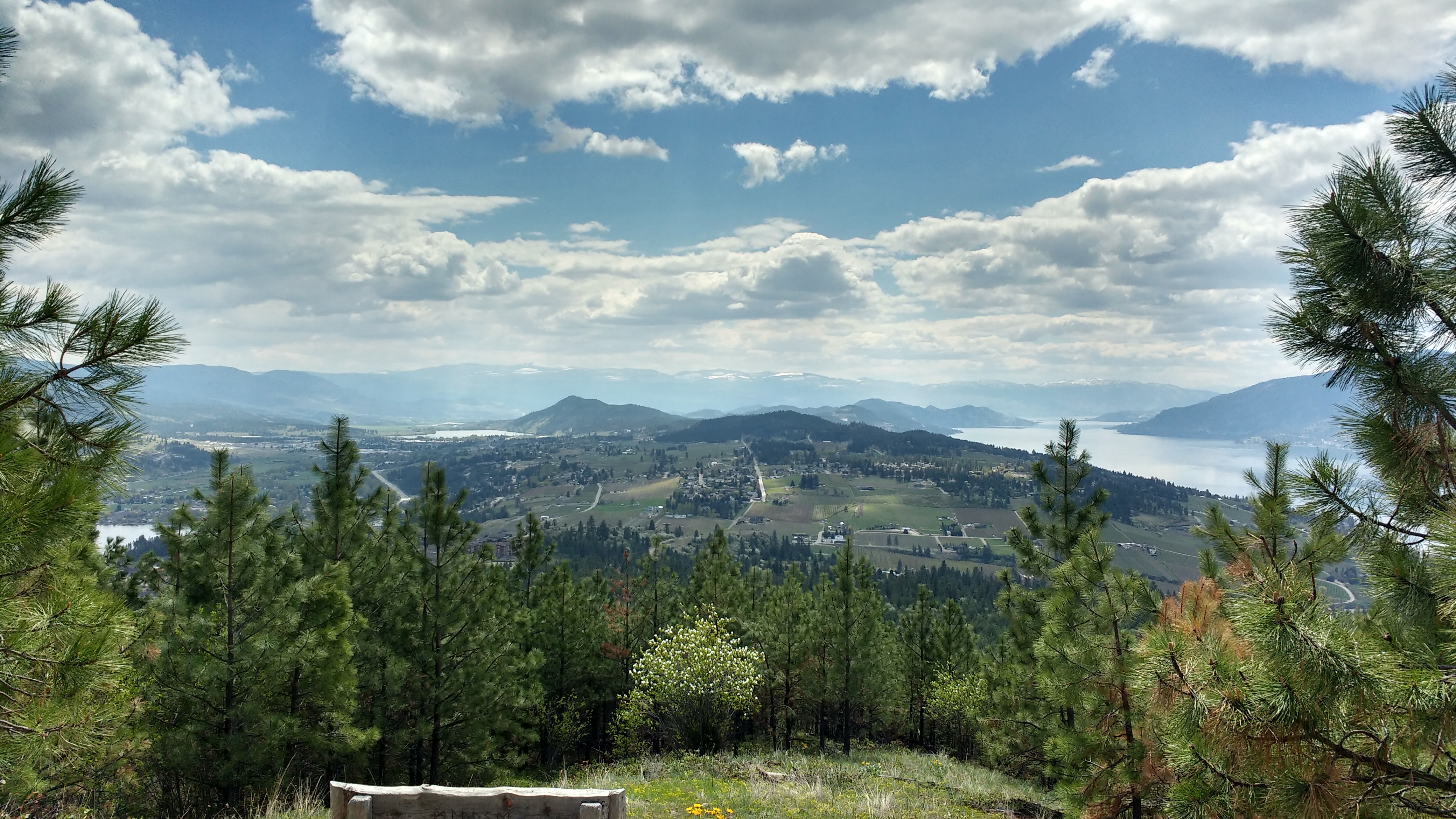
Spion Kop is a significant peak in Lake Country. Much of the area is very steep with varying degrees of vegetation density and frequent amazing views. There is an extensive trail network used by hikers, runners, dirt bikes, ATVs, and some mountain bikes. The scrub brush can be a bit stiff and scratchy, so it would be best to wear long pants for the off-trail travel.
The arrowleaf balsamroot is hanging on and has been joined by other wildflowers, notably the paintbrush!
Spion Kop is a very popular trail network, especially now with people looking for healthful social distancing activities. Please keep this in mind when you plan your visit. If you can go in the early morning, the trails will likely be less busy.
The map is brand new this spring. We have not had time to finish it to full orienteering standard. In particular, the vegetation, contours and cliffs are 100% computer generated and the trails have been added entirely from online sources. This map has not been field checked, except for a few very specific and limited places. Please be aware that there will be trails that are not on the map and, less commonly, there may be trails on the map that are not obvious on the ground.
Having said the above, the map should be good enough to enjoy some beautiful orienteering!
Courses
The start/finish location is at the end of a scenic drive to the Spion Kop Raven Ridge Trailhead above Carrs Landing Road on the west side of
the trail network. Parking is along the side of the road.
Each control has the control code written on a strip of flagging tape attached to it. You can use this code to verify that you have found the correct control, but please try to avoid touching the control. If your printed map is black and white, you can carry a cell phone with the pdf on it to check the map in colour if you need it, which can be helpful to identify features such as vegetation and clearings.
The distances specified below are as the crow flies between controls. You will run further.
Beginner: 2.0 km straight-line distance in some nice rolling forest. Controls are near trails and generally easily visible. This is Spion Kop, though, so there is still a good amount of climbing and descending.
Intermediate: 3.3 km straight-line distance with more off-trail travel and more challenging navigation to the controls. This is the same as the lower part of the advanced course. It is targeted at those who have been doing the beginner course and have expressed an interest in a greater challenge.
Advanced: 5.8 km straight-line distance with a lot of climbing and descending, some of it quite steep, depending on route choice. This also means that there are some spectacular views. There is opportunity for more off-trail travel on this course compared to recent courses. There is a logical shortcut that removes a lot of climbing and descending and turns this into the intermediate course.
Overview
Due to the exceptional global circumstances at the moment, we will not be having our usual events. Instead, we are setting up trainings that can be completed in your own time, any time, over the coming weeks. For all the trainings we will be hanging some flags in the woods for a few weeks, and individually emailing out maps. You print out the pdf to get your own map (or if you are very careful, keep it on your cellphone) to use.
We are choosing training location very carefully to be locations
that tend to have low public use to maximize social distancing, but are
relatively close to the city to minimize travel. We will be on
forested maps exclusively, and not using any of the park maps in the
city that are already over-crowded. We have some new maps in the works,
but will also be returning to some previously used ones.
Precautions
- Please stay home if you have any symptoms of illness.
- Only participate in orienteering activities with individuals from your immediate household.
- Stay at least 2 metres away from all other park/wilderness users and do not congregate at the trailheads or control sites.
- Do not touch the control(checkpoint) flags – just get within 5 metres or so.
- Walk/run with extreme caution to avoid any injuries.
- It is tick season! Check yourself when you're done and when you get home.
Cost
These trainings are being offered as a free mental health service to all Sage Orienteering Club members. Now is a great time to go for a run by yourself or in a very small group in the beautiful Okanagan nature.
How it Works
- Register your Sage Orienteering Club membership online on Zone4. Payment and waiver are both online on Zone4 this year.
- Send an email to xnavor@gmail.com to register for the course of your choice and let us know how many of you are going. We will email you a map individually - so make sure your email address with your WhyJustRun account is accurate.
- Run the course whenever you want during the times when the event is open. If you are interested in comparing results & routes with others, record a GPS track on your smartwatch or phone.
- (Optional) Upload a .gpx file (you can export this from Strava, Garmin Connect, Attackpoint, and many others) to our website (link will be posted once registration is open) which will calculate your split times. We will also then overlay all the GPS tracks onto the map together so you can compare routechoices with others. We might not be able to gather socially, but we can still talk about or routechoices digitally.
How You Can Help
These events are running entirely on volunteer manpower. We would love some help if you would be willing to pick up controls at a specified times at the end of each event, and handing them on to the next volunteer who will put them out.