
Sage Stomp Revelstoke
September 30th 2023 9:00am - October 1st 2023 2:00pm
Organizers: David Bakker (Event Director), David Bakker (Course Planner), Bart Jarmula (Course Planner), Brian May (Controller), Abbigail May (Assistant), Kevin Matrosovs (Assistant)
Map: Mount Macpherson
Results
Classic
Adventure Run
Maps
The 38th annual Sage Stomp moves to Revelstoke for the first time! There might not be sage brush or open grassland, but there is a full weekend of excellent orienteering in the cedars and hemlocks.
Saturday AM - Training/Instruction
Check-In Opens at 9:00 am. Beginner Instruction at 9:15 am. Course closes at 11:30 am.
- Experienced Orienteers: A solo training opportunity.
- Beginner Orienteers: Small-group coached session working our way around appropriate courses.
- Organization Team:
- Course Planner: David Bakker
- Controller: Abbi May
- Map: Mount Macpherson NW, 2017-2019, David Bakker, ISOM2017, 5 m contours.
- Course: Up to 4.8 km, with shortcut options to make it much shorter.
- Walk to Start: ~ 1 km up a logging road. Finish at parking/arena.
- Finish is right at the parking area.
- No water available on course, but available at the finish.
Parking Location: 50.975540, -118.240847, (click for Google Map pin)
Saturday PM - Classic
First Start at 1:00 pm. Last Start at 2:00 pm. Course closes at 4:00 pm.
- Organization Team:
- Course Planner: David Bakker
- Controller: Brian May
- Map: Mount Macpherson North, 2017-2019, David Bakker, ISOM2017, 5 m contours.
- Walk to Start: 200 m to the South of the Parking area
- Finish is right at the parking area.
- No water available on course, but available at the finish.
|
Course |
Beginner |
Intermediate |
Advanced |
Expert |
Elite |
|
Distance |
2.2 km |
2.7 km |
2.5 km |
4.5 km |
6.7 km |
|
Climb |
110 m |
125 m |
130 m |
265 m |
385 m |
|
Scale |
1:7500 |
1:7500 |
1:7500 |
1:10000 |
1:10000 |
Advanced/Expert/Elite all feature technically difficult navigation. No assigned start times on any course, open start window.
Parking Location: Same parking as Saturday morning
Sunday AM - 3 Hour Adventure Run
Registration Opens: 8:30 am. Mandatory Instructions at 9:10 am. Map distribution 9:20 am. Mass Start at 9:30 am. Course closes at 12:30 pm.
- Planning Team
- Course Planner: Bart Jarmula
- Controller: David Bakker
- Map: Mount Macpherson North, 2017-2019, David Bakker, ISOM2017, 5 m contours. 1:10000 print scale (UPDATED!!!).
- Start/Finish & Parking at the Nordic Lodge.
- (UPDATED) Score-O with bonus dogbone controls. Choose your own route to cover as many controls as possible in three hours. The highest score wins the event. In case of a tie, then the faster time is the tiebreaker. Thirty controls total valued 10, 20, or 30 points. There are ten controls of each value giving 600 points for the controls themselves. There are two pairs of bonus dogbone controls. If you combine the dogbone controls consecutively (no other controls in between) you will triple the points for these specific controls. There are 200 bonus points available (one combo adds 120 points, the other adds 80 points), for a total of 800 points.
- 5 point penalty per minute late.
- Expect approximately 18 km of travel to score maximum points (13-15 km to visit all controls).
- Consider bringing a pen to plan your course (plus any other desired planning tools).
- Be aware that all single track trails may have mountain bike traffic. You will come across trails signed as one way for mountain biking. You can travel uphill on these trails but please use extra caution.
Participation in groups is encouraged, but solo participants are also welcome.
You must carry a whistle and some sort of clock (watch, cell phone, etc.). We strongly encourage you to carry water, food, a small first aid kit, extra clothing and/or emergency blanket, and a compass. We will not have water out on course.
Parking Location: 50.942969, -118.222635
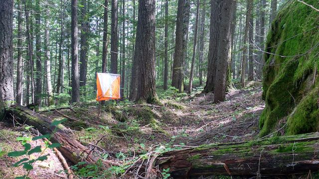
Terrain
The terrain comprises a spectacular interior rain forest, with a mixture of white, open forest and greener areas of slower running. Large and small contour features are on offer, with a healthy dose of water and rock. A trail network varying from very light to very dense covers the map as well, making the area suitable for orienteers of all skill levels.
New Orienteers
Our event is beginner friendly. The instruction on Saturday morning is targeted to new orienteers. Each event will have a Beginner course suitable for new orienteers. We look forward to meeting you!
Registration
To register, go here: https://2mev.com/#!/events/sage-stomp-2023
Registration closes on Wednesday, September 27th at 23:59.
Costs
Training:
- Adult (Born in 2002 and earlier): $10
- Junior (Born in 2003 and later): $5
Classic:
- Adult (Born in 2002 and earlier): $25
- Junior (Born in 2003 and later): $10
Adventure Run:
- Adult (Born in 2002 and earlier): $25
- Junior (Born in 2003 and later): $10
Event Timing
Timing will be done with the SI timing system. SI cards will be available to all registrants as part of your registration fee, although if you have your own we encourage you to use it. Participants are also encouraged to carry a GPS (a cell phone is ok, as long as it is not used for the purposes of navigation during the event - please carry one for safety!) so that we can set up a 3D Re-Run for each course. Start times will not be assigned (we will spread out competitors on each course). Split starts will be available for parents of small children (contact the event director to arrange). Live Results will be available online during the event (use the link above).
Volunteer
We still need some help jobs on the weekend, like control pickup. If you are able to help, please get in touch!
Awards
Modest prizes will be given out by course for the Classic and Adventure Run.
Accommodation
Camping and more luxurious accommodation are available in and around Revelstoke.
Camping is NOT permitted on the map.Food
Very limited refreshments will be offered at the finish. You are encouraged to have food and water at your car. Porta-potties will be available (TBC).
Water will not be supplied on course - you should carry your own water.
Safety Info
- Cell Coverage: All events occur in areas with cell coverage. There are small zones in low lying areas without coverage.
- Wildlife: There may be bears in the area, carry bear spray if you wish.
- Other Users: The area has lots of mountain bikers. Please be courteous to fellow trail users.
Contact
Questions? Feel free and send the event director David Bakker an email at contact AT SageOrienteering.ca