
Pileated Woods Map information
Statistics
| Scale | 1:4,000 |
|---|---|
| Map standard | ISSprOM |
| Events on map | 2 |
Notes
2 Meter contours Hand Traced from processed LiDAR basemap.
PRODUCTION AND REVISIONS:
Created in OpenOrienteeringMapper in 2016 by David Bakker. Rootstocks need updating or removing from the map.
LAND OWNERSHIP:
City of Salmon Arm Park
DATA AGREEMENTS:
None
MAJOR EVENTS:
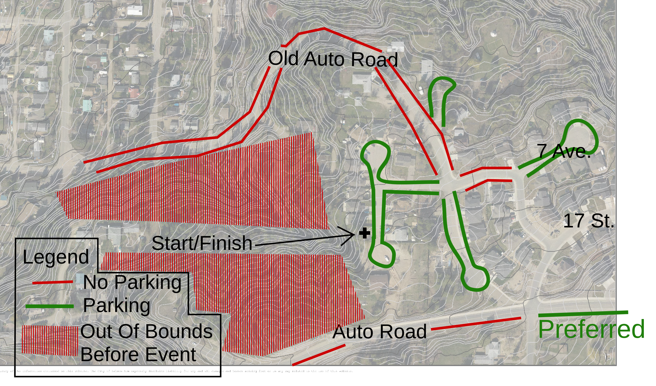
None.SAFETY BEARING:
Safety Bearing: South to Auto Road.
CELL PHONE COVERAGE:
- Telus/Koodoo/Public Mobile/Bell/Virgin - Excellent.
- Rogers - Not Tested
UNIQUE SAFETY CONCERNS:
- Traffic on Auto Road
EMERGENCY INFORMATION:
- Nearest Hospital: Shuswap General Hospital
- Shuswap Volunteer Search And Rescue: Call 911
- RCMP: Call 911
START/PARKING CO-ORDINATES:
- Access off of 11st St SE: 50.694034, -119.272964
PICTURE TAKEN BY SAGE ON MAP:
None taken yet.
---------------------------
Great for a FARSTA or similar event. Very small map, works great on a half letter sized paper at 1:4000. That is what the prepared image is at 300dpi.
Map image
Events on this map
| Series | Date |
|---|---|
| Pileated Woods (SA) | Jun 5, 2017 |
| Pileated Woods (SA) | Jun 18, 2018 |