
Telemark Adventure Run 2025 Kelowna
October 26th 2025 10:00am - 2:00pm
Organizers: Kevin Matrosovs (Event Director), Nick sunderland (Assistant), Tammy Howe (Assistant), Patrick Goeres (Assistant), Phil Wallensteen (Coach), David Bakker (Coach), Kevin Matrosovs (Course Planner), Kevin Matrosovs (Permit)
Map: Telemark
Post-Event
The weather held and we had a great day! Thank you to those volunteers who donated their time to help make this event happen!
Results
LiveLox GPS Tracks
Updates
- October 18:
- Added event-day schedule
- October 17:
- Cadets Canada participants -- register using a different link provided by your training officer
- October 10:
- Registration is now open! See the Registration section below. Telemark Nordic Team members -- register using a different link provided by your coach.
- Event schedule -- exact check-in and start times -- will be finalized soon.
Overview
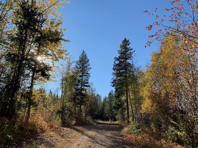
We are excited to return to the ski and snowshoe trail network and forest of the Telemark Nordic Club for another orienteering adventure run!
This is a Score-O style adventure run on a computer-generated map. We expect to offer 1.5 hour and 3 hour categories. You choose how far and how long -- within the time limit -- you want to go. Come out and experience the Telemark trails and forest before ski season!
Keep an eye on this page as more information and registration will be added soon!
Location, Parking, and Map
This event will take place in the area of the Telemark Nordic Club trail network and some additional nearby forest. Parking is at the Telemark parking lot and the start/finish is in the arena in front of the main Telemark lodge.
The map is all you need to choose your own adventure. It will have all the checkpoints clearly marked on it, and will clearly show which areas are out of bounds. A compass may be beneficial on the longer course, but is not needed (the map is oriented to magnetic north, so no declination is required).
The map is not quite a standard orienteering map. It does, however, have vehicle tracks, trails, water features (creeks, ponds, and marshes, which are likely fairly dry now), 5-metre contours, some boulders and cliffs, and computer generated vegetation density. While all of the trails have been verified, most of the off-trail terrain between trails has not been field-checked.
There has been some recent logging work done in a few small areas of the map.
Courses
Everyone gets the same map, it has a mix of different checkpoint difficulties and distances from the start/finish.
Different checkpoints will be worth different points depending on
how far away they are or how difficult they are to find. The goal is to
collect as many points as you can within the time limit.
Course Options:
You get a choice of how long you want to be out there, and we will compare results and routes within two different time limits:
- 1.5 Hour Adventure Run
- 3 Hour Adventure Run
Mandatory and Recommended Equipment
Mandatory Equipment:
- Map -- we will provide this
- Whistle -- for emergencies
- Watch and/or mobile phone -- so that you can return to the finish on time!
Recommended and Optional Equipment:
- Water -- especially on the 3 Hour course
- Energy food / snacks -- especially on the 3 Hour course
- Appropriate clothing for the weather
- Long pants / leg covering to protect your legs if you plan to run fast off trail through the forest
- Compass is recommended
New Orienteers
We are making this event friendly to new orienteers. We are offering beginner friendly courses and will ensure we have someone available at check-in to help you with getting started in the sport. We look forward to meeting you!
We encourage those new to orienteering and forest navigation to team up and participate as a group of 2-3.
Juniors age 15 and under MUST participate in groups of 2-3 or with an adult.
Schedule
This is a one day, in person, event on Sunday October 26.
Please check-in as early as possible so that we don't have a big rush right at the last minute.
- 09:00 -- Check-in opens
- 09:40 -- Check-in closes
- 09:45 -- Course maps handed out
- 09:55 -- Pre-race briefing
- 10:00 -- Start
- 11:30 -- Finish time limit for 1.5 Hour category
- 13:00 -- Finish time limit for 3 Hour category
Registration
Online registration closes at on Thursday, October 23, at 11:30pm. Please register early! There will be no on-site day-of-event registration.
Telemark Nordic Team Participants:
- All Telemark Nordic Team participants will be in the 1.5 hour category.
- SEE YOUR TELEMARK COACH FOR THE REGISTRATION LINK.
Cadets Canada Participants:
- All Cadets Canada participants will be in the 1.5 hour category.
- SEE YOUR TRAINING OFFICER FOR THE REGISTRATION LINK.
All Other Participants:
- Members of Sage or any Canadian orienteering club:
- Adult (age 21 and older): $15
- Junior (age 20 and under): $5
- Non-Members (Day-of-Event Members):
- Adult (age 21 and older): $20
- Junior (age 20 and under): $10
Safety
Prepare to be self-sufficient for the duration of your run!
- All participants must report to the finish, so we know you're safe.
- All participants must carry a whistle for use in emergencies.
- Juniors age 15 and under MUST participate in groups of 2-3.
- BE BEAR AWARE. Consider carrying bear spray if you are nervous about bear encounters.
- There may also be moose in some areas of the forest. If you hear or see one, give it a wide berth.
- There are no water stations on the course. Take some with you, especially on the 3 hour course.
- Consider taking some food if you're on the 3 hour course.
Results
SI timing will be used for this event. Timing chips for borrowing are included in your registration price. We also encourage you to track your run/walk with a GPS, so we can put together an animation of where everyone went. We will be manually calculating your points, and will publish results and routes once the event is over.
Scoring
Depending on how far the checkpoint is from the start/finish and how difficult or physically demanding it is to find it is worth a different amount of points. The most challenging checkpoints are worth 120 points, intermediate difficulty checkpoints are 80 points, and the closest and easiest are worth 40.
For each minute that you or your team is back late past your time limit, a penalty of 20 points is deducted from your score. Don't be late!