
Burnt Ida Bench Self-Directed Training Salmon Arm
April 10th 2024 8:00am - April 21st 2024 6:00pm
Organizer: Phil Wallensteen (Event Director)
Map: Burnt Ida Bench
Registration for this activity is now closed.
Spring has definitely sprung, so we are back at it with some orienteering (sorry for being a bit late this year)! Through April and the beginning of May, we plan on having self-directed trainings around the Salmon Arm area, and then are hoping to have some more in person trainings/events in later May and June.
Map
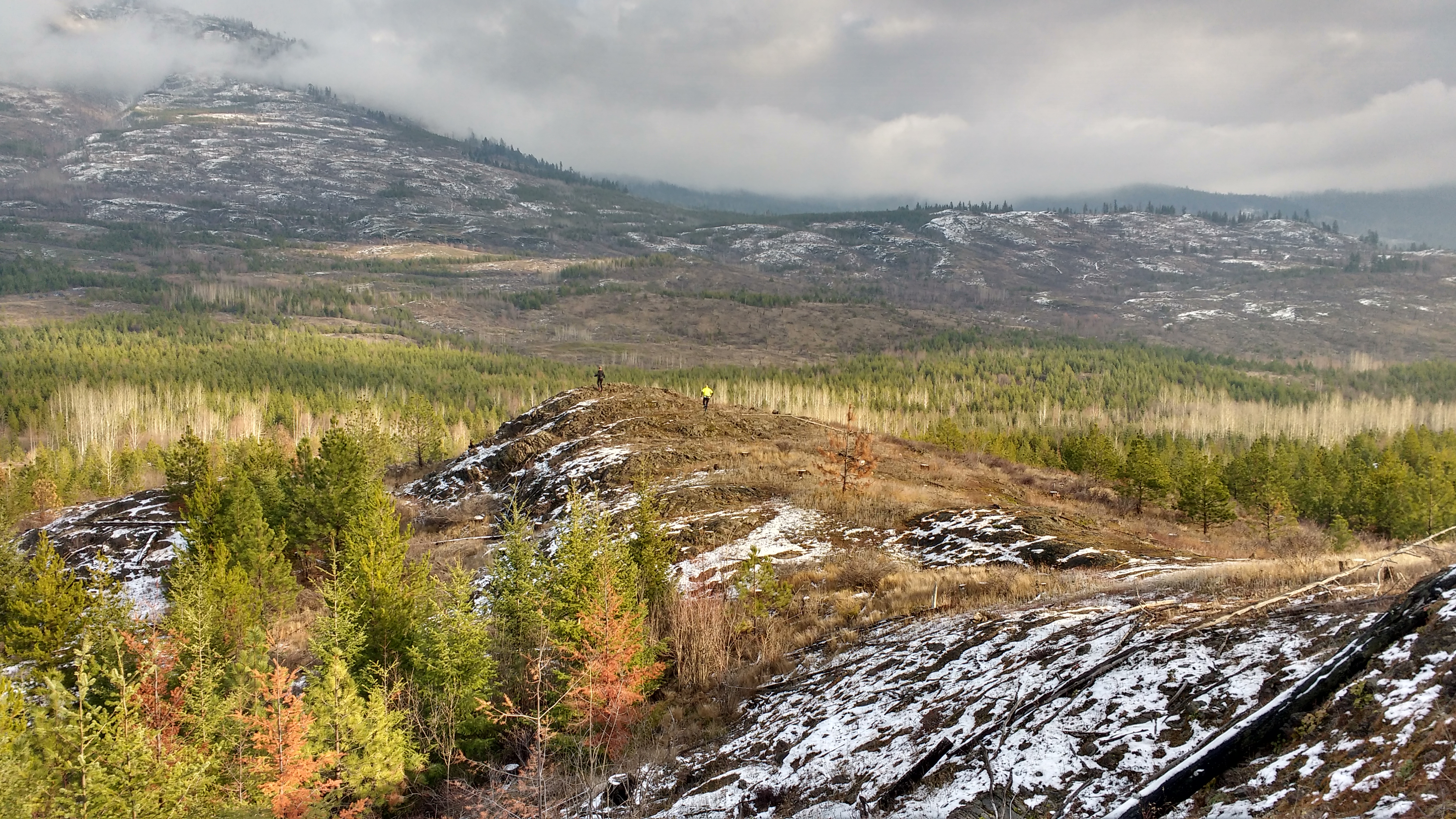
This event will take place on the Burnt Ida Bench map on the western slopes of Mount Ida. This is the first time we have used this map for a club event, and it isn't quite perfect yet. The map uses computer-generated vegetation, which isn't quite as well mapped as a normal fieldchecked map. Nevertheless, the map quality is much, much better than your typical non-orienteering map :)
The terrain in this area is simply beautiful and amazing. If you have never been to this area, it is totally worth the trip to check it out.
The terrain back in fall 2018, no snow on the ground anymore!
Location & Parking
Access if from the Haines Creek area off of Salmon River road. Turn into the Silver Creek Community Park and take the road to the left in the first 75 meters. At 4.5 km from the pavement there is a road that goes left down the hill into private land. The start/finish/parking is 4.7 km from the pavement by some old culverts. There is a wide spot with lots of room to park and the orange and white start/finish flags are on the lower side of the road. The hills on the road at .5 km and 3 km are better than they have been for several years. If there is a heavy rain I would wait for a day or two for things to dry out since the road and some trails have very sticky mud. Things were very dry Sunday for this time of year.
Courses
There is just one course which is set at around an Intermediate level of navigational difficulty. If you do the whole thing, it is 9.3 km long, but there are quite a few good options to take shortcuts if you want something a little bit shorter.
If you pick the 1:10000 scale, then it does not fit on one piece of paper, and you need to download both of the 1:10000 files and print both out.
A reminder that in either case, the contours on the map are are 5 m.
Orienteering maps are quite detailed so it is very worthwhile reviewing a map legend to ensure you are using the map to it's full potential. Here is a good resource to check out.
Cost
These self-directed events are being offered for free to all Sage Orienteering Club members. In order to participate, EVERYONE in your group must have an active 2024 Sage Orienteering Club membership. If you'd like to contribute financially towards these events consider adding a donation when you sign up for your membership.
Helping Out
These events are organized by volunteers. If you can help out with picking up the ribbons for this event, please let us know at contact@sageorienteering.ca. Thanks!
How it Works
- Register your Sage Orienteering Club and for the event (combined registration form, which will prompt you to register for your membership if you haven't yet registered as a member for 2024).
- Download the course maps (as PDFs) from the registration confirmation.
- Print the map, or load the map onto your phone.
- Do the course whenever you want during the time when the event is open. All participants (whether they have a map or not) need to be Sage Orienteering Club members, but it is really, really cheap so invite a friend to come along!